The case of the collapsing soil

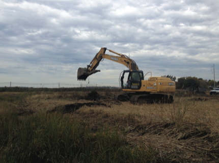
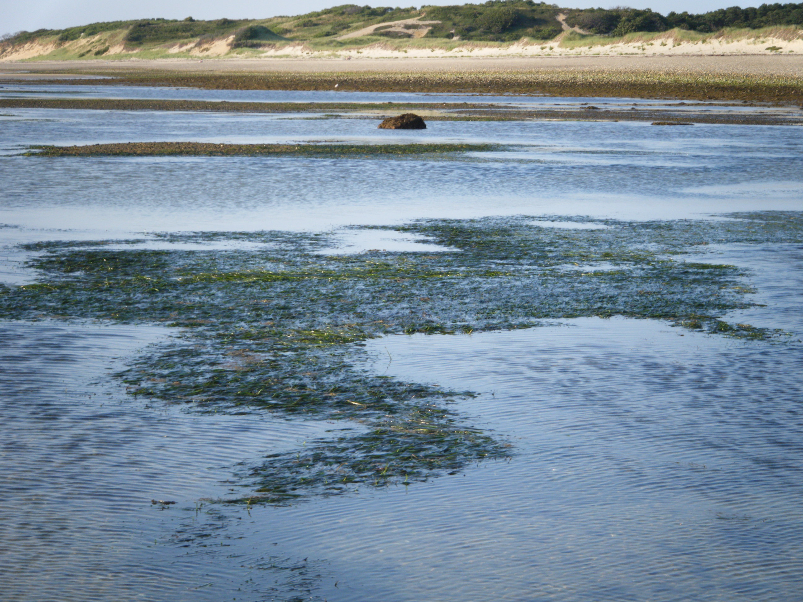
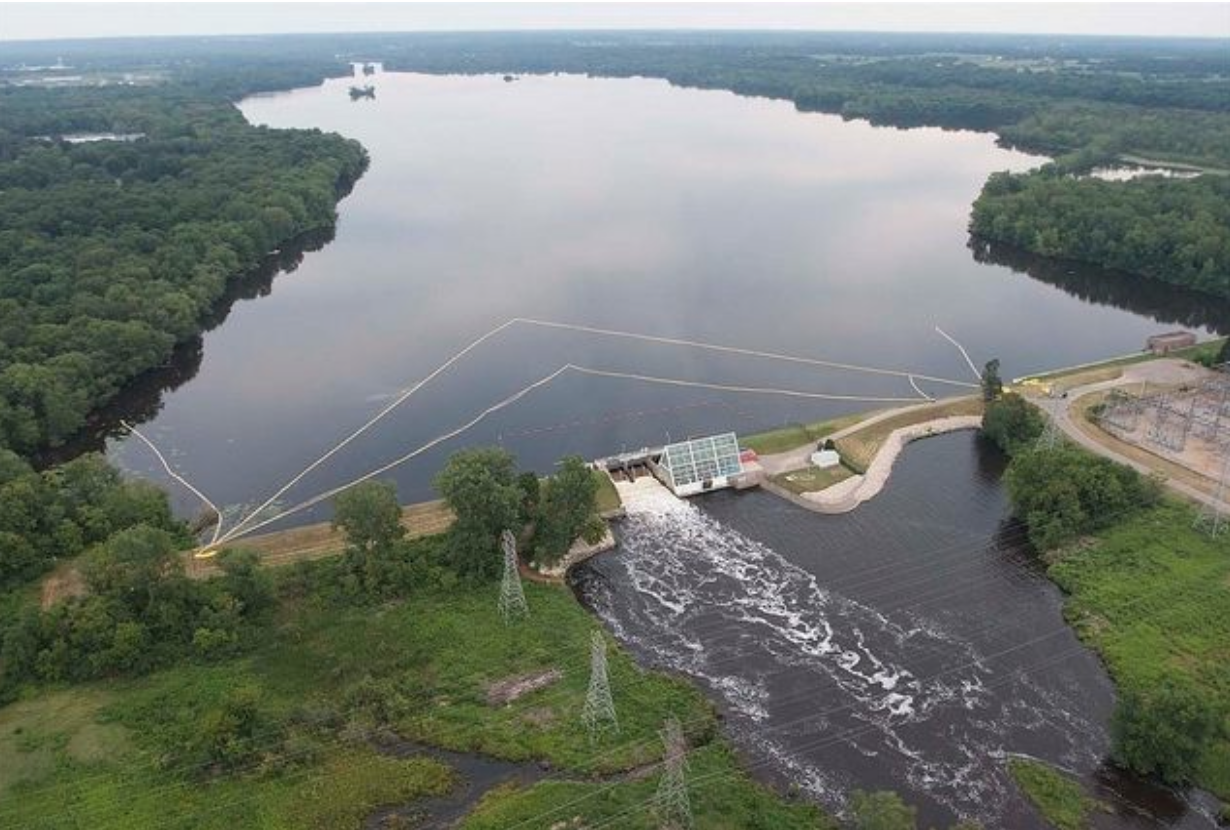
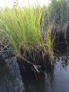
An area in the Florida Everglades where strange soil collapse has been observed.

The activities are as follows:

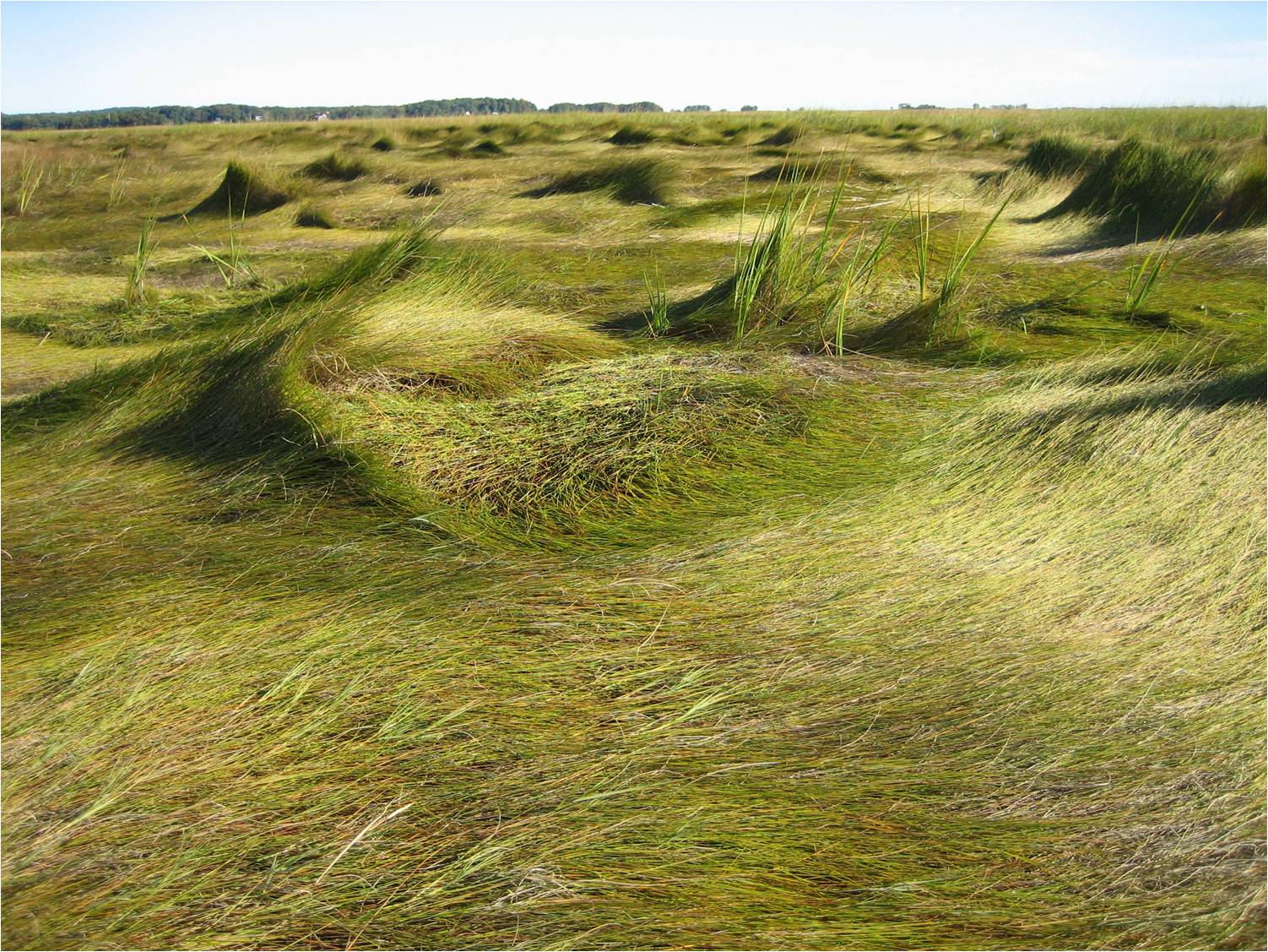
As winds blow through the large expanses of grass in the Florida Everglades, it looks like flowing water. This “river of grass” is home to a wide diversity of plants and animals, including both the American Alligator and the American Crocodile. The Everglades ecosystem is the largest sub-tropical wetland in North America. One third of Floridians rely on the Everglades for water. Unfortunately, this iconic wetland is threatened by rising sea levels caused by climate change. Sea level rise is caused by higher global temperatures leading to thermal expansion of water, land-ice melt, and changes in ocean currents.

With rising seas, one important feature of the Florida Everglades may change. There are currently large amounts of carbon stored in the wetland’s muddy soils. By holding carbon in the mud, coastal wetlands are able to help in the fight against climate change. However, under stressful conditions like being submersed in sea water, soil microbes increase respiration. During respiration, carbon stored in the soil is released as carbon dioxide (CO2), a greenhouse gas. As sea level rises, soil microbes are predicted to release stored carbon and contribute to the greenhouse effect, making climate change worse.

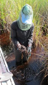
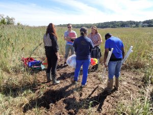
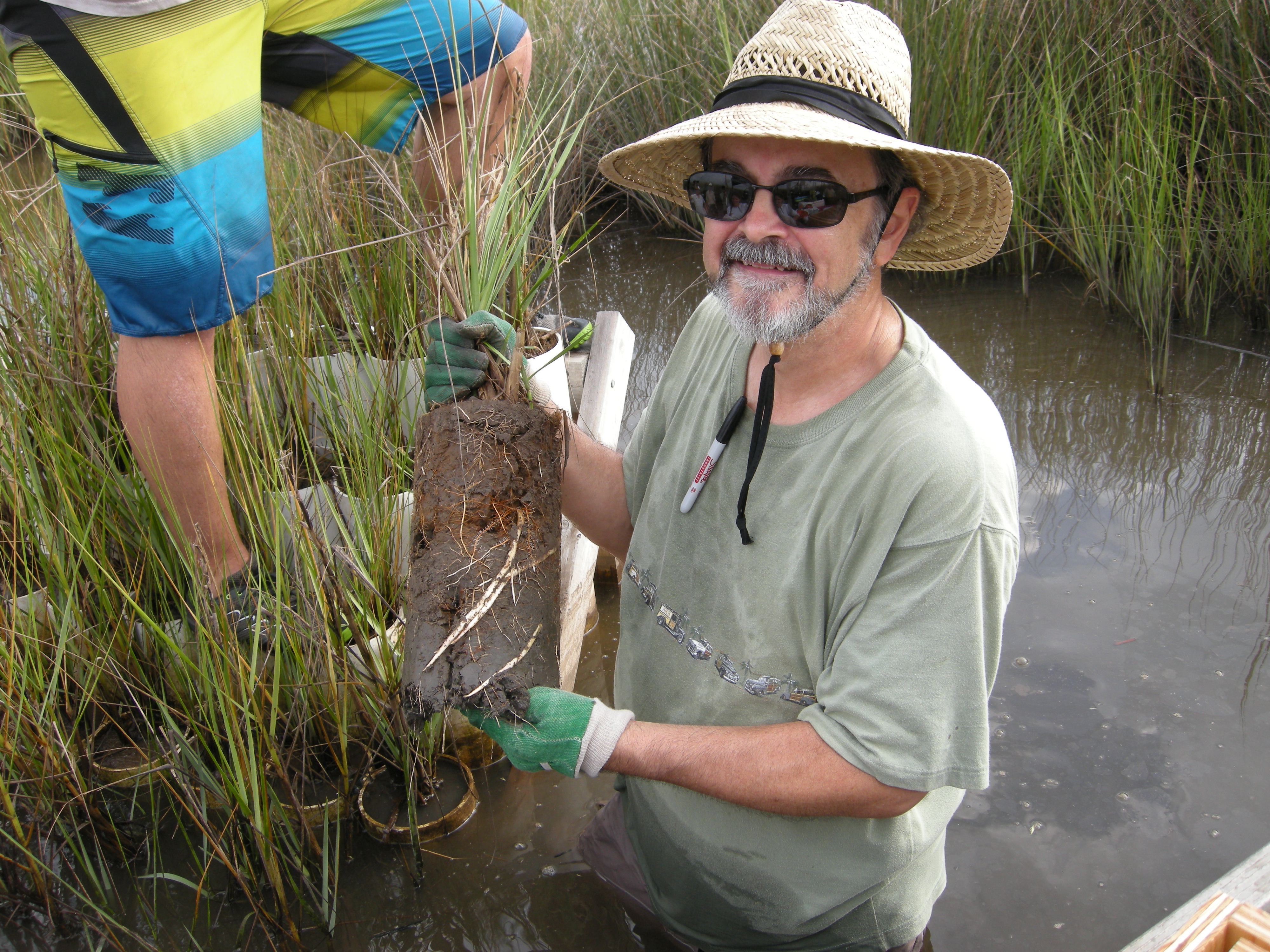
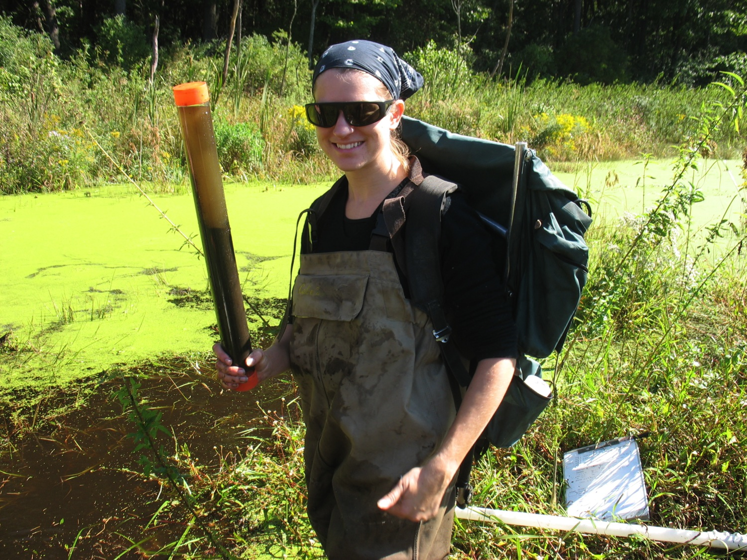
Shelby collecting soil samples from areas where the soil has collapsed in the Everglades.

Shelby and John are ecologists who work in southern Florida. John became fascinated with the Everglades during his first visit 10 years ago and has been studying this unique ecosystem ever since. Shelby is interested in learning how climate change will affect the environment, and the Everglades is a great place to start! They are both very concerned with protecting the Everglades and other wetlands. Recently when John, Shelby, and their fellow scientists were out working in the Everglades they noticed something very strange. It looked like areas of the wetland were collapsing! What could be the cause of this strange event?

John and Shelby thought it might have something to do loss of carbon due to sea level rise. They wanted to test whether the collapsing soils were the result of increased microbial respiration, leading to loss of carbon from the soil, due to stressful conditions from sea level rise. They set out to test two particular aspects of sea water that might be stressful to microbes – salt and phosphorus.

Phosphorus is found in sea water and is a nutrient essential for life. However, too much phosphorus can lead to over enriched soils and change the way that microbes use carbon. Sea water also contains salt, which can stress soil microbes and kill plants when there is too much. Previous research has shown that both salt and phosphorus exposure on their own increase respiration rates of soil microbes.

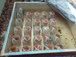
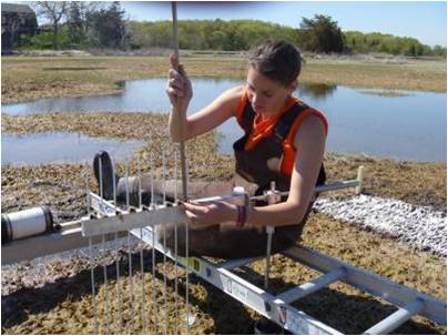
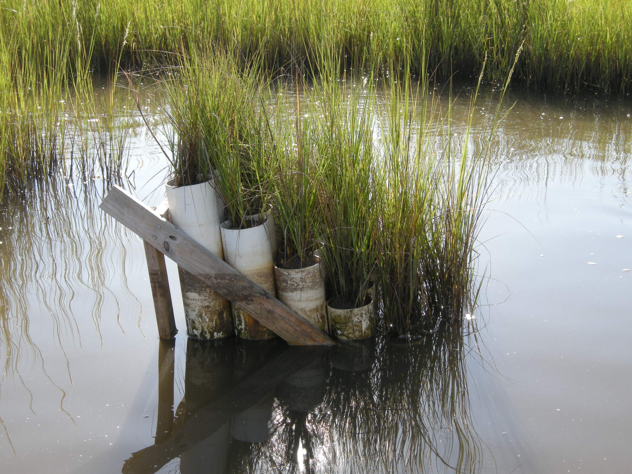
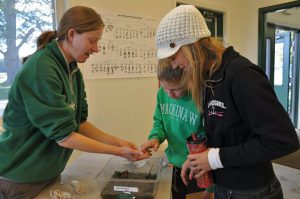
A photo of the experimental setup. Each container has a different level of salt and phosphorus concentration.

To test their hypotheses, a team of ecologists in John’s lab developed an experiment using soils from the Everglades. They collected soil from areas where the soil had collapsed and brought it into the lab. These soils had the microbes from the Everglades in them. Once in the lab, they put their soil and microbes into small vials and exposed them to 5 different concentrations of salt, and 5 different concentrations of phosphorus. The experiment crossed each level of the two treatments. This means they had soil in every possible combination of treatments – some with high salt and low phosphorus, some in low salt and high phosphorus, and so on. Their experiment ran for 5 weeks. At the end of the 5 weeks they measured the amount of COreleased from the soils.

Featured scientists: John Kominoski and Shelby Servais from Florida International University. Written by Shelby, John, and Teresa Casal.

Flesch–Kincaid Reading Grade Level = 9.2

SaveSave

SaveSave

SaveSave

SaveSave

SaveSave

SaveSave

SaveSave

SaveSave

SaveSave

SaveSave

Marsh makeover

A saltmarsh near Boston, MA being restored after it was degraded by human activity.

The activities are as follows:

Salt marshes are diverse and productive ecosystems, and are found where the land meets the sea. They contain very unique plant species that are able to tolerate flooding during high tide and greater salt levels found in seawater. Healthy salt marshes are filled with many species of native grasses. These grasses provide food and nesting grounds for lots of important animals. They also help remove pollution from the land before it reaches the sea. The grass roots protect the shoreline from erosion during powerful storms. Sadly today, humans have disturbed most of the salt marshes around the world. As salt marshes are disturbed, native plant biodiversity, and the services that marshes provide to us, are lost.

A very important role of salt marshes is that they are able to store carbon, and the amount they store is called their carbon storage capacity. Carbon is stored in marshes in the form of both dead and living plant tissue, called biomass. Marsh grasses photosynthesize, taking carbon dioxide out of the atmosphere and storing it in plant biomass. This biomass then falls into the mud and the carbon is stored there for a very long time. Salt marshes have waterlogged muddy soils that are low in oxygen. Because of the lack of oxygen, decomposition of dead plant tissue is much slower than it is in land habitats where oxygen is plentiful. All of this stored carbon can help lower the levels of carbon dioxide in our atmosphere. This means that healthy and diverse salt marshes are very important to help fight climate change.

However, as humans change the health of salt marshes, we may also change the amount of carbon being stored. As humans disturb marshes, they may lower the biodiversity and fewer plant species can grow in the area. The less plant species growing in the marsh, the less biomass there will be. Without biomass falling into the mud and getting trapped where there is little oxygen, the carbon storage capacity of disturbed marshes may go down.

Jennifer, working alongside students, to collect biomass data for a restored saltmarsh.

It is because of the important role that marshes play in climate change that Jennifer, and her students, spend a lot of time getting muddy in saltmarshes. Jennifer wants to know more about the carbon storage capacity of healthy marshes, and also those that have been disturbed by human activity. She also wants to know whether it is possible to restore degraded salt marshes to help improve their carbon storage capacity. Much of her work focuses on comparing how degraded and newly restored marshes to healthy marshes. By looking at the differences and similarities, she can document the ways that restoration can help increase carbon storage. Since Jennifer and her students work in urban areas with a lot of development along the coast, there are lots of degraded marshes that can be restored. If she can show how important restoring marshes is for increasing plant diversity and helping to combat climate change, then hopefully people in the area will spend more money and effort on marsh restoration.

Jennifer predicted that: 1) healthy marshes will have a higher diversity of native vegetation and greater biomass than degraded salt marshes, 2) restored marshes will have a lower or intermediate level of biomass depending on how long it has been since the marsh was restored, and 3) newly restored marshes will have lower biomass, while marshes that were restored further in the past will have higher biomass.

To test her predictions, Jennifer studied two different salt marshes near Boston, Massachusetts, called Oak Island and Neponset. Within each marsh she sampled several sites that had different restoration histories. She also included some degraded sites that had never been restored for a comparison. Jen measured the total number of different plant species and plant biomass at multiple locations across all study sites. These measurements would give Jen an idea of how much carbon was being stored at each of the sites.

Featured scientist: Jennifer Bowen from Northeastern University

Flesch–Kincaid Reading Grade Level = 11.0

Keeping up with the sea level

A view of salt marsh hay (Spartina patens) growing in a marsh

A view of salt marsh hay (Spartina patens) growing in a marsh

The activities are as follows:

Salt marshes are ecosystems that occur along much of the coast of New England in the United States. Salt marshes are very important – they serve as habitat for many species, are a safer breeding location for many fish, absorb nutrients from fertilizer and sewage coming from land and prevent them from entering the ocean, and protect the coast from erosion during storms.

Unfortunately, rising sea levels are threatening these important ecosystems. Sea level is the elevation of the ocean water surface compared to the elevation of the soil surface. Two processes are causing sea levels to rise. First, as our world gets warmer, ocean waters are getting warmer too. When water warms, it also expands. This expansion causes ocean water to take up more space and it will continue to creep higher and higher onto the surrounding coastal land. Second, freshwater frozen in ice on land, such as glaciers in Antarctica, is now melting and running into the oceans. Along the New England coast, sea levels have risen by 0.26 cm a year for the last 80 years, and by 0.4 cm a year for the last 20 years. Because marshes are such important habitats, scientists want to know whether they can keep up with sea level rise.

Researcher Sam Bond taking Sediment Elevation Table (SET) measurements in the marsh

Researcher Sam Bond taking Sediment Elevation Table (SET) measurements in the marsh

When exploring the marsh, Anne, a scientist at the Plum Island Ecosystems Long Term Ecological Research site, noticed that the salt marsh appeared to be changing over time. One species of plant, salt marsh cordgrass (Spartina alterniflora), appeared to be increasing in some areas. At the same time, some areas with another species of plant, salt marsh hay (Spartina patens), appeared to be dying back. Each of these species of plants is growing in the soil on the marsh floor and needs to keep its leaves above the surface of the water. As sea levels rise, the elevation of the marsh soil must rise as well so the plants have ground high enough to keep them above sea level. Basically, it is like a race between the marsh floor and sea level to see who can stay on top!

Anne and her colleges measured how fast marsh soil elevation was changing near both species of plants. They set up monitoring points in the marsh using a device called the Sediment Elevation Table (SET). SET is a pole set deep in the marsh that does not move or change in elevation. On top of this pole there is an arm with measuring rods that record the height of the marsh surface. The SETs were set up in 2 sites where there is salt marsh cordgrass and 2 sites where there is salt marsh hay. Anne has been taking these measurements for more than a decade. If the marsh surface is rising at the same rate as the sea, perhaps these marshes will continue to do well in the future.

Featured scientist: Anne Giblin from the Marine Biological Laboratory and the Plum Island Ecosystems Long-Term Ecological Research site

Flesch–Kincaid Reading Grade Level = 9.1

Additional resources related to this Data Nugget:

Is your salt marsh in the zone?

Scientist James collecting plants in a Massachusetts marsh, part of the Plum Island Ecosystems Long Term Ecological Research site

Scientist James collecting plants in a Massachusetts marsh, part of the Plum Island Ecosystems Long Term Ecological Research site

The activities are as follows:

Tides are the rise and fall of ocean water levels, and happen every day like clockwork. Gravity from the moon and sun drive the tides. There is a high tide and a low tide, and the average height of the tide is called the mean sea level. The mean sea level changes seasonally due to the warming and cooling of the ocean throughout the year. It also changes annually due to a long-term trend of ocean warming and the melting of glaciers. Scientific evidence shows that climate change is causing the sea level to rise faster now than it has in the past. As the climate continues to warm, it is predicted that the sea level will continue to rise.

Salt marshes are wetlands with plains of grass that grow along much of the ocean’s coast worldwide. These marshes are important habitats for many plants and animals, and protect our shores from erosion during storms. They grow between mean sea level and the level of high tide. Marshes flood during high tide and are exposed to the air during low tide. The health of a salt marsh is determined by where it sits relative to the tide (the “zone”). A healthy marsh is flooded only part of the time. Too much flooding and too little flooding are unhealthy. Because they are so important, scientists want to know if salt marshes will keep up with sea level rise caused by climate change.

A picture of James’ “marsh organ” which holds plants at different elevations relative to mean sea level. He gave it that name because it resembles organ pipes!

A picture of James’ “marsh organ” which holds plants at different elevations relative to mean sea level. He gave it that name because it resembles organ pipes!

In the 1980s, scientist James began measuring the growth of marsh grasses. He was surprised to find that there was a long-term trend of increasing grass growth over the years. James wanted to know if grasses could continue to keep up with rising sea levels. If he could experimentally manipulate the height of the grasses, relative to mean sea level, he might be able to figure out how grasses will do when sea levels are higher. To test this, James invented a way to experimentally grow a marsh at different elevations relative to mean sea level. He built a device he called the “marsh organ”. This device is made of tubes that stand at different elevations and are filled with marsh mud and planted with marsh grasses. He measured the growth of the grass in each of the pipes. If grasses will continue to grow taller in the future with higher water levels, then plants growing in pipes at lower elevations should grow more than plants growing in pipes with higher elevations.

Featured scientist: James Morris from the University of South Carolina

Additional teacher resource related to this Data Nugget: Jim has created an interactive salt marsh model called the “marsh equilibrium model”. This online tool allows you to plug in different marsh levels to explore potential impacts to the salt marsh. To explore this tool click here.

To read more about Jim’s research on “tipping points” beyond which sediment accumulation fails to keep up with rising sea level and the marshes drown, click here.

There are two publications related to the data included in this activity:

  • Morris, J.T., Sundberg, K., and Hopkinson, C.S. 2013. Salt marsh primary production and its responses to relative sea level and nutrients in estuaries at Plum Island, Massachusetts, and North Inlet, South Carolina, USA. Oceanography 26:78-84.
  • Morris, J.T., P.V. Sundareshwar, C.T. Nietch, B. Kjerfve, D.R. Cahoon. 2002. Responses of coastal wetlands to rising sea level. Ecology 83:2869-2877.

SaveSave

Green crabs: invaders in the Great Marsh

Scientist Alyssa holding a non-native green crab, introduced from Europe to the American Atlantic Coast. This crab causes many problems in its new range, including the loss of native eelgrass.

Scientist Alyssa holding a non-native green crab, introduced from Europe to the American Atlantic Coast. This crab causes many problems in its new range, including the loss of native eelgrass.

The activities are as follows:

Marshes, areas along the coast that flood with each tide, are incredibly important habitats. They act as homes to large number of species, protect the coast from erosion during storms, and act as a filter for nutrients and pollution. Many species are unique to these habitats and provide crucial support to the marsh. For example, native eelgrass, a type of plant, minimizes erosion by holding sediments in place with their roots.

In an effort to help protect and restore marshes, we must understand current-day issues that are affecting their health. The introduction of non-native species, species that are not originally from this ecosystem, into a marsh may disrupt the marsh ecosystem and threaten the survival of native species. One species that has recently caused a lot of trouble is the European green crab. This crab species was accidentally carried to the Atlantic coast back in the early 1800s from Europe. Since then, they have become extremely invasive and their numbers have exploded! Compared to native crabs, the green crab digs a lot when it searches for food and shelter. This digging uproots eelgrass and causes its population numbers to fall. In many spots where green crabs have been introduced, marshes are now bare and no more grass can grow.

Non-native green crabs caught in trap that has been underwater for 25 hours

Non-native green crabs caught in trap that has been underwater for 25 hours

The Great Marsh is one of the coastal habitats affected by invasive green crabs. Located on the North Shore of Massachusetts, the Great Marsh is known for being the longest continuous stretch of salt marsh in all of New England. Alyssa is a restoration ecologist who is very concerned with the conservation of the Great Marsh and other important coastal ecosystems. She and other scientists are trying to maintain native species while also reducing the effects of non-native species.

A major goal for Alyssa is to restore populations of a native eelgrass. Eelgrass does more than just prevent erosion. It also improves water quality, provides food and habitat for native animal species, and acts as an indicator of marsh health. If green crabs are responsible for the loss of eelgrass from the marsh, then restorations where eelgrass is planted back into the marsh should be more successful where green crab numbers are low. Alyssa has been measuring green crab populations in different areas by laying out green crab traps for 24 hours. Alyssa has set these traps around Essex Bay, an area within the Great Marsh. She recorded the total number of green crabs caught at each location (as well as their body size and sex).

Native eelgrass growing in Essex Bay, an area within the Great Marsh

Native eelgrass growing in Essex Bay, an area within the Great Marsh

Featured scientist: Alyssa Novak, Center for Coastal Studies/Boston University. Written by: Hanna Morgensen

Flesch–Kincaid Reading Grade Level = 8.8

Marvelous mud

mud

You can tell that the mud in this picture is high in organic matter because it is dark brown and mucky (in real life you’d be able to smell it, too!)

The activities are as follows:

The goopy, mucky, often stinky mud at the bottom of a wetland or lake is a very important part of the ecosystem. Wetland mud is much more than just wet dirt. For example, many species of microbes live in the wetland mud where they decompose (breakdown) dead plant and animal material to obtain energy. This dead plant and animal material is called organic matter. However, the wetland mud microbes do not have all the oxygen they need to decompose the plant and animal tissues quickly and efficiently. Because of this, the dead material in wetland mud decomposes much more slowly than similar dead material in dry soil.

A successful core! You can see that the tube has mud, as well as some of the water from the wetland that was on top of the mud.

A successful core! You can see that the tube has mud, as well as some of the water from the wetland that was on top of the mud.

As a graduate student, Lauren became fascinated with wetland mud and its interesting properties. She wanted to know how important all the mud and its organic matter is for wetlands. By talking with other members of her lab and reading scientific papers, Lauren learned that wetland mud can often be high in the element phosphorus and that phosphorus acts as a fertilizer for plants, including wetland plants and algae. However, nutrients, such as phosphorus can build up in wetland mud. Lauren thought it might be possible that the organic matter in the mud was the source of all the phosphorus in some wetlands. She predicted that wetlands with more organic matter would have more phosphorus. If her data support her hypothesis, it could mean that organic matter is very important for wetlands, because nutrients are needed for algae and plants to grow.

Although most mud is high in organic matter and nutrients, not all mud is the same. There is natural variation in the amount of organic matter and nutrients from place to place. Even within the same location mud can be very different in spots. Lauren used this variability to test her ideas. She measured organic matter and phosphorus in mud from 16 freshwater locations (four lakes, five ponds, and seven wetlands). She took cores that allowed her to sample mud deep into the ground. She then brought her cores back to the lab and measured organic matter and phosphorus levels in her samples.

Featured scientist: Lauren Kinsman-Costello from Kent State University

Flesch–Kincaid Reading Grade Level = 9.8

More photos associated with this research can be found here. There is one scientific paper associated with the data in this Data Nugget. The citation and PDF of the paper is below:

Kinsman-Costello LE, J O’Brien, SK Hamilton (2014) Re-flooding a Historically Drained Wetland Leads to Rapid Sediment Phosphorus Release. Ecosystems 17:641-656

SaveSave

SaveSave

SaveSave

SaveSave

SaveSave

SaveSave

Finding a Foothold

The activities are as follows:

Have you ever noticed that the ground at a beach has rocks of many different sizes? These rocks, sand, and dirt are all called substrates. The types of substrate we see are described by the size of the particles that cover the ground. These can range from large boulders down to fine grains of sand and dirt, with many sizes in between. No matter what type of substrate you see at the beach, you can find organisms that will live in or on it. Just like there are different types of substrates, there are different types of organisms that can live there. How can we determine which types of organisms prefer which types of substrates? That is the job of field researchers!

mollusk-3

Students collecting mollusk data on different beach substrates.

Students and teachers at Kentridge High School have made many field trips to the beach and have seen lots of organisms. Normally, they just noticed what they could see easily in front of them. Students became interested to know how the type of substrate influences which organisms will live there. They noticed that the snails in the aquarium at school like to stick to the glass walls of the tank. Do snails and other shelled mollusks found near the ocean, like chitons, periwinkles, whelks and limpets, also like to live on large, stable substrates? The students went to beach to find out!

Mollusks have a “foot” which may be able to attach more securely to larger substrates, such as boulders, and allow them more room to move. So, the students expected to find more mollusks on boulders than on other types of substrates. To gather the data needed to answer this question, the students went to a local beach. They looked at sections of the beach with substrates of all types. On these different substrates, they kept track of all the different types of organisms that were present. They measured the frequency that they observed four types of mollusks (chitons, limpets, whelks, and periwinkles) on the following substrates: boulder, gravel, pebble, logs, sand, and shell debris. Frequency was measured as the proportion of times that a particular organism was present on a substrate type, out of the total number of observations. For example, if they observed 2 boulders and saw limpets on 1, the frequency would = ½ or 0.5.

Featured scientists: Darrel Nash and Sarah Hall from Kentridge High School, Washington

Flesch–Kincaid Reading Grade Level = 7.4

For more information on the Seattle Aquarium’s citizen science project, and to download the dataset from this project, click here

Float down the Kalamazoo River

Morrow Lake, a reservoir created along the Kalamazoo River. The water is held in a reservoir by a dam. When water flows into the reservoir it slows, potentially letting some of the total suspended solids settle to the bottom of the river.

Morrow Lake, a reservoir created along the Kalamazoo River. The water is held in a reservoir by a dam. When water flows into the reservoir it slows, potentially letting some of the total suspended solids settle to the bottom of the river.

The activities are as follows:

Ever since she was a kid, rivers have fascinated Leila. One of her hobbies is to kayak and canoe down the Kalamazoo River in Michigan, near where she lives. For her work, she researches all the living things in the river and how humans affect them. She is especially interested in changes in the river food web, caused by humans building dams along the river, and an oil spill in 2010.

Leila knows there is a lot more in river water than what meets the eye! As the river flows, it picks up bits of dead plants, single-celled algae, and other living and nonliving particles from the bottom of the river. The mix of all these particles is called total suspended solids (TSS) because these particles are suspended in the river water as it flows. The food web in the Kalamazoo River depends on the particles that are floating in the water. Invertebrates eat decomposing leaves and algae, and fish eat the invertebrates.

Leila showing off some of the cool invertebrates that can be found in the Kalamazoo River.

Leila showing off some of the cool invertebrates that can be found in the Kalamazoo River.

As you float down the river, particles settle to the river bottom and new ones are picked up. The amount of suspended solids in a river is influenced by how fast the water in the river is flowing. The faster the water flows, the more particles are picked up and carried down the river. The slower the water flows, the more particles will settle to the bottom. Discharge is a measure of how fast water is flowing. You can think about discharge as the number of cubes (one foot on each side) filled with water that pass by a point every second. During certain times of the year, water flows faster and there is more discharge. In spring, when the snow starts melting, a lot of water drains from the land into the river. There also tends to be a lot more rain in the fall. Things humans build on the river can also affect discharge. For example, we build dams to generate hydroelectric power by capturing the energy from flowing water. Dams slow the flow of river water, and therefore they may cause some of the suspended solids to settle out of the water and onto the bottom of the river.

Leila wanted to test how a dam that was built on the Kalamazoo River influenced total suspended solids. If the dam is reducing the amount of total suspended solids, it could have negative effects on the food chain. She was also curious to see if the dam has different effects depending on the time of year. On eight different days from May to October in 2009, Leila measured total suspended solids at two locations along river. She collected water samples upstream of the dam, before the water enters the reservoir, and samples downstream after the water has been in the reservoir and passed over the dam. She also measured discharge downstream of the dam.

KalamazooRiver

Featured scientist: Leila Desotelle from Michigan State University

Flesch–Kincaid Reading Grade Level = 8.7

If your students are looking for more information on how the amount of water flowing in the river affects the food chain and the health of the ecosystem overall, check out the video below!