The activities are as follows:
- Teacher Guide
- Student activity, Graph Type A, Level 4
- Student activity, Graph Type B, Level 4
- Student activity, Graph Type C, Level 4
- PowerPoint of images
- Land Acknowledgement
- Grading Rubric
Forests, wetlands, and other green spaces are natural filters for water; water is cleaned as it is used by plants and travels through soils. As green spaces are lost to make room for homes and businesses, ecosystems are less able to provide this service. Without natural filtration from green spaces, humans must build expensive water treatment systems or risk drinking contaminated water.
Impervious surfaces, like roads, buildings, and parking lots, do not allow water to pass through. When it rains or snows on an impervious surface, water cannot soak into soil or be used by plants. Instead, it quickly flows into nearby streams and rivers. If too much water runs off too quickly, it overwhelms local sewer systems, getting into rivers before it can be filtered. This dirty water may carry human waste and toxic materials.
Impervious surfaces have become a major problem for both the health of river ecosystems, and the health of people who depend on them as a clean source of drinking water. How land is used in a watershed, or the network of land and rivers that flow to a single point as they empty out into the ocean, is an issue of great concern.
Jonathan is a scientist studying land use. He became interested in science after traveling around the country and working as a wilderness ranger and wildland firefighter. At the Harvard Forest, members of his lab study how land use decisions affect the environment. They used computer simulations to create maps of what New England’s landscape could look like under different possible futures. Their web-tool is called the New England Landscapes Futures Explorer. Johnathan’s lab works with Drew, a civil and environmental engineer who loves biking and hiking. Drew and his lab at Smith College are interested in the relationship between land use and water. Together, Jonathan and Drew’s labs teamed up to study how future increases in impervious surfaces from new development could affect water quality in New England.
A team of scientists decided to use the web-tool to study the Merrimack River. The Merrimack is an important river for New England, and serves as a water source for more than 500,000 people in the region. It begins in New Hampshire, and flows through 117 miles of forests, farmland, and cities before emptying into the Atlantic Ocean.
To study the Merrimack, the scientists used their web-tool and data from two nearby similar watersheds to make predictions for the Merrimack. Combining research like this gives scientists, government organizations, and the public valuable information that can be used to help make decisions about how land should be used in the future.
Jonathan’s lab used their future land use predictions to estimate the percentage of impervious surface area in the Merrimack River watershed for three future scenarios in the year 2060.
- Recent Trends: This scenario takes the historical rates and patterns of land use change from 1990-2010 and projects them through 2060. This scenario imagines a future where we maintain current land use practices.
- Low Development: This scenario explores a future where the people of New England shift toward a lifestyle focused on “living local” and valuing reliance on local resources. This increases the urgency to protect local landscapes, including conservation of green spaces. Rates of development are slightly lower than the Recent Trends scenario.
- High Development: This scenario explores a future with a rapid increase in human population in New England, because climate change has made life in many other places more difficult. Rates of development are much higher than the Recent Trends scenario.
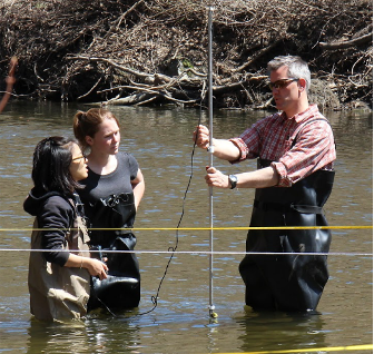
Drew’s team collected data from two watersheds adjacent to the Merrimack river (see map) and calculated the annual maximum daily flow, or the highest level that the river in each watershed would be expected to reach each day. Higher flows likely mean more human waste and toxic materials are getting into the river. These watersheds are similar to the Merrimack in some ways, but different in others. It is up to you to justify which watershed you think is most similar, and use the annual maximum daily flow data from that watershed to make your prediction for the Merrimack.
Featured scientists: Jonathan Thompson from Harvard University and Drew Guswa from Smith College. Written by Tara Goodhue and Joshua Plisinski. Supporting content by Amanda Suzzi.
Flesch–Kincaid Reading Grade Level = 11.3
Additional teacher resource related to this Data Nugget:
- Students can explore the New England Landscapes Futures Explorer online here!
