


- Teacher Guide
- Student activity, Graph Type A, Level 3
- Student activity, Graph Type B, Level 3
- Student activity, Graph Type C, Level 3
- Grading Rubric
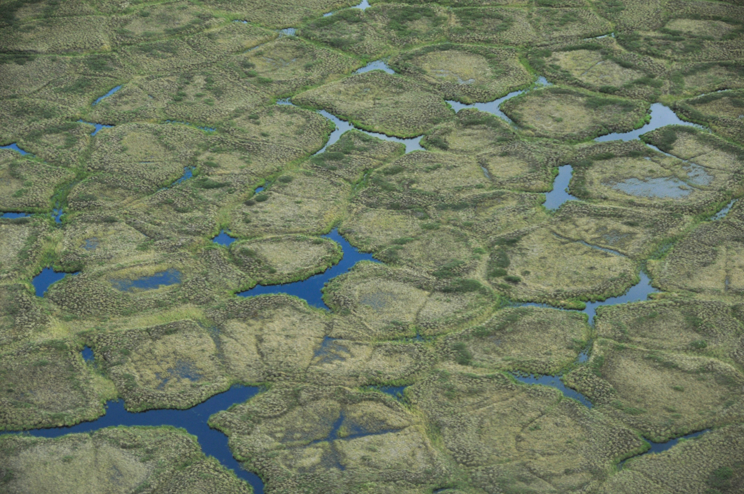
There is a strange phenomenon found in many Arctic regions. There, the natural landscape often has large repeating patterns called ice-wedge polygons. Understanding why they exist and how they form has been a puzzle for many years.
Today, scientists believe ice-wedge polygons form because of the extreme temperature swings in the arctic climate. During the cold winter, the soil contracts and cracks. In summer, water fills these cracks. When temperatures drop again in the fall, the water freezes and expands. Over many years, repeated cycles of cracking and freezing create large wedges of ice underground. These ice wedges connect to form polygon-shaped patterns across the landscape.
As they continue to grow, the wedges create microhabitats, or small areas that are close to each other, but differ in physical conditions. The polygons have wet centers, slightly raised and drier rims, and water-filled troughs around the edges. The microhabitats affect water movement, nutrient distribution, carbon cycling, biodiversity, and habitat for animals. The polygon microhabitats are also important carbon sinks – meaning the plants living there take in and store more carbon than they release.
Anja is a scientist working in the Arctic. She first became interested in the connections between plants, soil, and ice when she hiked across the Arctic tundra in northern Alaska for her graduate school research. She got her rubber boots stuck in the deep troughs of the melting ice covering the land. While getting unstuck, she observed the ice-wedge polygons and became curious about the plants that live in each area of the polygons. She was curious whether each microhabitat influences how carbon moves between the land and the atmosphere.
Anja wanted to investigate how much carbon is absorbed by different microhabitats within the polygons. Plants take up carbon dioxide (CO2) from the atmosphere during photosynthesis and use it to build new plant material. She observed that different plant communities grew in different areas of the polygons. The polygon rims have more shrubs and are drier. The troughs have more sedges, which are similar to grasses, and seem to have the wettest conditions. The centers have sedges and moss communities and are wet, but not as wet as the troughs. She thought that the wet plant communities found in the polygon centers would absorb the most carbon because their soil moisture conditions are most favorable for photosynthesis. The conditions in the dry rims and flooded troughs could be more stressful for plants to grow in.
Anja hiked across the Alaskan Arctic tundra at the height of summer again. She marked the location of several well-developed ice-wedge polygons and identified the center, rim, and trough microhabitats within each polygon. She set up three plots in each type of microhabitat as replicates.
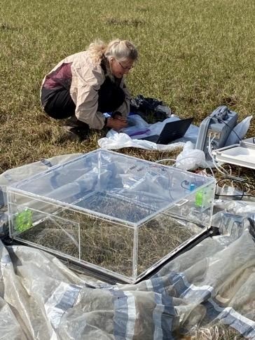
To measure carbon flux, Anja used a clear chamber connected to an infrared gas analyzer. This instrument measured net ecosystem productivity (NEP), which shows the balance of carbon taken up through photosynthesis and released through respiration. Anja used this instrument to measure the amount of CO2 moving into or out of the atmosphere each second over a square meter within each plot.
Featured scientist: Anja Kade (she/her) from University of Alaska Fairbanks